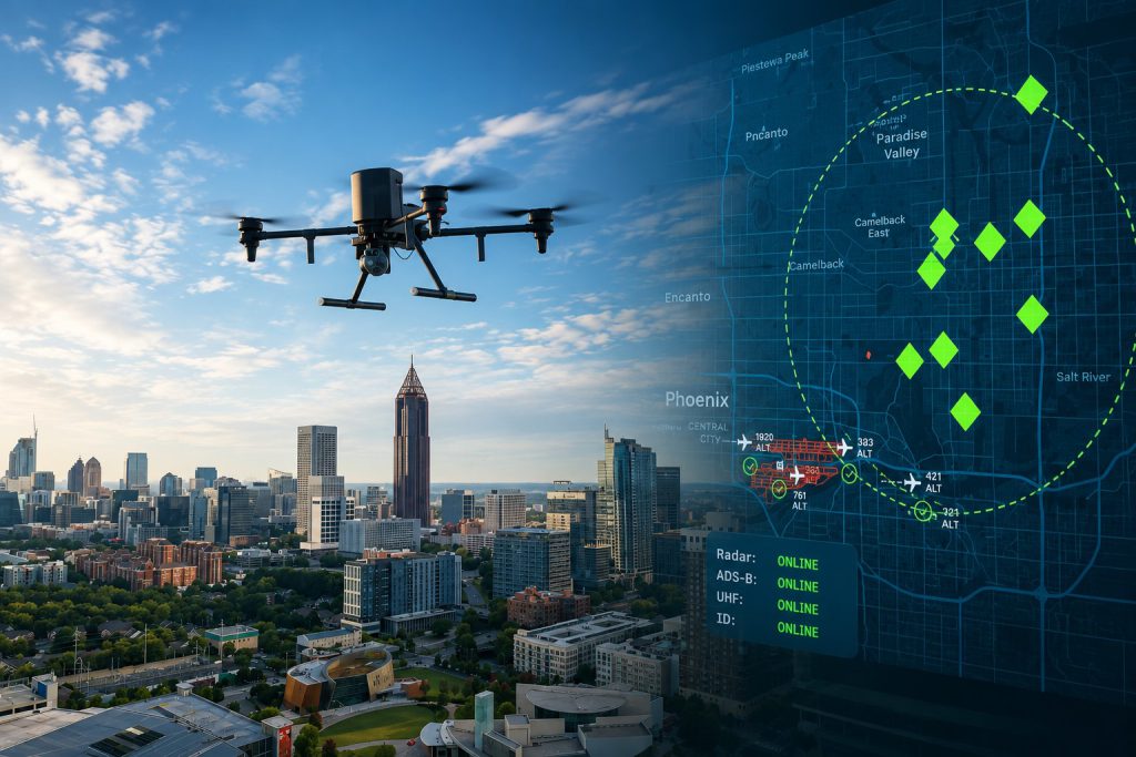
Something quietly historic happened in the skies above American communities this summer. A company most people have never heard of, operating out of Atlanta, Georgia, with a valuation of $7.5 billion and over 1,100 employees, rolled out what it describes as the fastest drone ever built for law enforcement. The Flock Safety Alpha — unveiled on October 16, 2025, and now entering active early-access deployment with police departments across the country — can reach 60 miles per hour, read a vehicle’s license plate from 2,000 feet in the air, carry thermal imaging that outperforms all American competitors, swap its battery in 90 seconds and return to the sky, and be launched by a single police officer from a smartphone. It can be deployed in response to a 911 call, a gunshot detection alert, or a hit from a ground-level license plate reader. And it arrives on scene before patrol cars do 78 per cent of the time.
Something quietly historic happened in the skies above American communities this summer. A company most people have never heard of, operating out of Atlanta, Georgia, with a valuation of $7.5 billion and over 1,100 employees, rolled out what it describes as the fastest drone ever built for law enforcement. The Flock Safety Alpha — unveiled on October 16, 2025, and now entering active early-access deployment with police departments across the country — can reach 60 miles per hour, read a vehicle’s license plate from 2,000 feet in the air, carry thermal imaging that outperforms all American competitors, swap its battery in 90 seconds and return to the sky, and be launched by a single police officer from a smartphone. It can be deployed in response to a 911 call, a gunshot detection alert, or a hit from a ground-level license plate reader. And it arrives on scene before patrol cars do 78 per cent of the time.
That last statistic is Flock’s own, and it captures both the genuine public safety argument for this technology and the reason civil liberties organisations, community advocates, and city councils from Minneapolis to Middletown are engaged in some of the most contested technology governance debates in recent American municipal history. A drone that arrives first on scene 78 per cent of the time is a drone that is also watching a neighbourhood before any officer has assessed whether a human response is needed. It is simultaneously a public safety tool and a surveillance infrastructure. And as cities across the country discover, those are not two separate things. They are the same machine.
The Company That Built a Surveillance Net — Then Took It Airborne
Flock Safety was founded in 2017 by Garrett Langley and began with a simple product: automated license plate readers, mounted on poles at neighbourhood entrances, that photographed every passing vehicle, captured the plate number, logged the time and location, and checked the reading against databases of stolen vehicles and plates associated with suspects. The pitch to suburban neighbourhood associations and small-town police departments was straightforward: passive, always-on crime detection that doesn’t require an officer to be present. Pay a monthly subscription, get eyes on every vehicle entering your community.
The company grew rapidly. By 2024, Flock’s ALPRs were deployed by over 5,000 law enforcement agencies and more than 2,000 communities across the United States. Its cameras collect data on millions of vehicles daily — not just the stolen ones, not just the suspect-flagged ones, but every vehicle, recorded regardless of whether the driver has ever been suspected of anything. That data — plate number, make, model, colour, location, time, and increasingly additional attributes like bumper stickers, roof racks, and visible vehicle damage — feeds into FlockOS, the company’s Real-Time Policing platform, which aggregates and makes searchable a surveillance dataset of vast scope.
The expansion into aerial surveillance was a natural, if alarming, extension of that platform. By partnering with Aerodome, an aviation software company, Flock integrated its existing ground-level surveillance infrastructure with an autonomous aerial component. A hit on a ground-level ALPR camera can now launch a drone that pursues the vehicle. A gunshot detected by an audio sensor can deploy a drone to the location in seconds. A 911 call can send a drone ahead of the ambulance, the fire truck, or the patrol car. The Alpha drone is not a separate product. It is the airborne node of a connected surveillance ecosystem that Flock has been building for eight years at ground level.
The Alpha Drone: What It Does and How It Does It
The Flock Alpha is designed around a single operational premise: get there first and see everything. Its technical specifications exist in service of that premise.
At 60 miles per hour, it is the fastest drone built for the Drone as First Responder category. DFR programs, which now operate in dozens of jurisdictions including Chula Vista, California — which has the most mature and most studied DFR program in the country — typically use drones that can reach a scene in two to three minutes, well ahead of the average patrol car response time of seven to ten minutes in many municipalities. The Alpha’s 60 mph capability compresses that advantage further.
The Alpha’s optics are its most consequential feature and the one generating the most discussion. The camera payload combines multiple optical sensors, a thermal imaging sensor operating at twice the performance of American competitors, a low-light capability designed for night operations, and a laser rangefinder — all housed in a single gimbaled head that stabilises imagery across flight and provides the ground track necessary for precise position reporting. The plate-reading range of 2,000 feet — approximately half a mile — is the specification that most directly bridges the Alpha’s aerial capabilities with Flock’s existing ALPR ground network. Flock’s earlier DFR platform cited 1,000-foot plate-read ranges. The Alpha doubles that distance. A drone that can read a license plate from half a mile away, flying at altitude, is for practical purposes invisible to anyone below it while remaining capable of identifying every vehicle in an area of multiple city blocks.
Four independent cellular modems provide connectivity redundancy — if one network fails, the mission continues on the remaining three. A weatherproof docking station stores the drone and charges it between deployments. The dual battery-swapping system enables a 90-second turnaround from landing to relaunch. The system integrates with FlockOS, with gunshot detection audio sensors, and with what Flock describes as leading external partners, meaning the Alpha can receive triggers from third-party sensor systems and feed its video back into any compatible dispatch or command infrastructure.
Deployment is controlled from a smartphone. When a trigger event fires — a 911 call matching the DFR criteria, a gunshot alert, an ALPR hit — an officer can launch the Alpha from the docking station remotely. The drone navigates autonomously to the GPS coordinates of the incident, takes up an observation position at whatever altitude provides optimal imagery, and streams live thermal and high-definition video to dispatchers and responding officers. Everything is logged. Every flight, according to Flock’s public communications, is posted to a transparency dashboard.
The Transparency Dashboard and Its Critics
Flock’s transparency framework is one of its most prominently promoted features, and it is also one of the most contested aspects of the DFR program model. The company’s public messaging has evolved significantly from its early years, when fixed ALPR cameras were presented primarily as a passive crime-detection tool. The current framing explicitly acknowledges the surveillance dimensions of the Alpha and presents the transparency dashboard — a publicly accessible record of every flight, including path, duration, and triggering event — as the mechanism that distinguishes responsible DFR use from general surveillance.
Flock now states publicly that Alpha activates only in response to specific calls for service, never for general patrol, with every flight logged and posted to a public transparency dashboard. DroneXL’s analysis of Flock’s marketing evolution noted that the first wave of messaging sold speed and endurance, and this current wave sells optics, thermal capability, and altitude-based plate reading.
Critics have two responses to the transparency dashboard. The first is procedural: logging what the drone did after the fact is not the same as preventing the drone from doing things it should not do in the first place, and a transparency dashboard is only as trustworthy as the institutional culture that populates it. The second is structural: the combination of capabilities available in the Alpha — plate reading at half a mile, thermal imaging at night, 90-second relaunch, smartphone control by any officer — creates an infrastructure that, even if used only for call-for-service responses, represents a qualitatively different surveillance environment than any previous technology available to American municipal police departments. The Electronic Frontier Foundation’s privacy litigation director Adam Schwartz described DFR programs as pouring gasoline on a fire that has been burning for fifteen years.
Cities in the Crossfire: Minneapolis, Middletown, Watertown, and Beyond
The debate over police drones is playing out simultaneously in communities across the country, and the outcomes have been varied, reflecting the genuine complexity of weighing demonstrated public safety benefits against equally genuine privacy and civil liberties concerns.
Minneapolis’s experience is the most extensively documented and the most politically charged. When Minneapolis police proposed a 75-day pilot program with Skydio — a California-based drone company — to deploy drones as first responders in north Minneapolis, the response was extraordinary. Residents packed City Hall on July 8, 2026, filling council chambers and an overflow room. More than 40 people signed up to speak at the Public Health, Safety and Equity Committee hearing. Not one of them spoke in favour of the proposal. 165 pages of written testimony were submitted opposing it. Community members cited the city’s history of racialised policing, the ongoing consent decree following George Floyd’s murder, the brutality findings of the Department of Justice, and concerns about Skydio’s relationships with federal immigration enforcement agencies and foreign military contractors. One resident, Avery Winters, captured the sentiment in a single sentence: What I don’t understand is why we would implement a drone program under the guise of public safety. We the people don’t trust the people or the system administering this.
On July 16, 2026, the Minneapolis City Council voted 6-6 on the Skydio pilot programme contract — a deadlock that, under council rules, resulted in the proposal’s failure. The drone pilot for north Minneapolis was rejected. The vote reflected something more than a technical objection to one vendor’s security relationships: it reflected a community’s assessment that the institution proposing to deploy the surveillance technology does not have the trust necessary to exercise that capability responsibly. Proponents argued the pilot had strict privacy guardrails, explicit call-for-service-only restrictions, full transparency logging, and alignment with state law. The community did not find those assurances sufficient. The programme is not permanently off the table — a motion to remove it from future agendas also failed 6-6 — but it is not happening in Minneapolis this year.
In Watertown, Massachusetts, the proposal is at an earlier stage. The Watertown Police Department is considering purchasing a Paladin Drones system at $24,000 purchase cost plus $49,000 annual operating cost. At a July 9, 2026, City Council Public Safety Committee hearing, police Chief Michael Hanrahan explicitly addressed the mission creep concern — the widely held worry that a tool proposed for one purpose will gradually expand to others. There will be written limitations in our policy, Hanrahan said. Everything will be logged. Every use of it will be logged. The transparency portal will be available to anyone who wants to see that. He was also explicit about what the drone was not: The camera is mounted on these things, but it’s not a surveillance tool in that respect. The deliberation continues.
Cathedral City, California, which has operated a drone program since 2018 and expanded it in 2026, told NBC Palm Springs that drones are deployed only in response to calls for service and that every flight is logged with documentation explaining the purpose of use. Sergeant Daniel Anes, who oversees the department’s drone program, said drones can launch from a desktop and arrive on scene within minutes, often before officers. The department says the technology has already cleared several calls per day that might otherwise require officers to drive across town.
Chula Vista, which has the longest-running and most formally evaluated DFR program in the country, has provided the most extensive evidence base for the public safety argument. Research on the Chula Vista program has documented genuine reductions in response time, a measurable increase in the proportion of calls resolved with video evidence of the incident, and, controversially, a study — disputed by privacy advocates — suggesting reductions in certain crime categories in covered zones. The American Civil Liberties Union has challenged that evidence as incomplete and has raised concerns about the program’s effect on community willingness to call 911 in communities that distrust police aerial surveillance.
The Fourth Amendment Question the Courts Haven’t Settled
The legal framework governing police drone surveillance is, in 2026, genuinely unsettled. The Supreme Court’s 2018 decision in Carpenter v. United States — which held that the government needs a warrant to access historical cell phone location data — established that the Third-Party Doctrine, under which information voluntarily shared with third parties loses Fourth Amendment protection, has limits in the digital age. But the court explicitly did not resolve how Carpenter applies to aerial surveillance. Lower courts have reached conflicting conclusions. No federal appellate court has established a comprehensive framework for when police need warrants to conduct drone surveillance of specific individuals or areas.
The practical implications of that legal ambiguity are significant for programs like Flock Alpha. Fixed ALPRs on public roads have been consistently held by courts not to require warrants because vehicles on public roads have no reasonable expectation of privacy in their license plates. Whether a drone that reads plates from 2,000 feet, tracks vehicle movements across a jurisdiction, and integrates that data into a real-time policing platform crosses into constitutionally protected territory is a question that will be decided in litigation that has not yet produced binding appellate precedent.
Several states have enacted statutes attempting to fill the gap. Michigan’s bipartisan drone package, including House Bill 5327, prohibits intrusive drone operations over private dwellings that interfere with a resident’s quiet enjoyment of their home. Minnesota’s legislature considered bills expanding the conditions under which police can legally use drones. Florida’s drone privacy statute, which has been in effect for several years, requires warrants for certain types of aerial surveillance. The patchwork of state laws does not map neatly onto the capabilities of a system like the Alpha, which can read plates and track movements at altitudes and distances that do not fall cleanly within the categories most state legislatures contemplated when they wrote their drone statutes.
The Immigration Enforcement Dimension
One of the most politically charged dimensions of the police drone debate in 2026 is the potential connection between DFR programs and federal immigration enforcement. In Minneapolis, Electronic Frontier Foundation’s Schwartz explicitly cautioned the city’s leaders about a system he described as custom-built for immigration enforcement to try to get their hands on. The concern is not hypothetical: under Operation Metro Surge — the Trump administration’s large-scale interior immigration enforcement campaign that ran through Minneapolis earlier in 2026, characterised by residents as a winter of military-equipped federal occupation — the question of whether local surveillance infrastructure would be shared with or accessed by Immigration and Customs Enforcement became acutely practical.
Skydio, the vendor Minneapolis ultimately rejected, has contracts with federal agencies and international military entities. Flock Safety’s data-sharing arrangements with federal law enforcement are a recurring subject of public comment at city council hearings wherever its products are under consideration. The company’s FlockOS platform integrates data from multiple Flock product lines into a searchable, real-time database — and while Flock’s public communications emphasise data security and access restrictions, the contractual and legal mechanisms by which federal agencies could compel access to that data under national security authorities or civil immigration subpoenas are not publicly detailed.
The immigration dimension reveals something important about why technical specifications alone cannot resolve the governance debate. A drone that can identify any vehicle in a half-mile radius from 2,000 feet is not a neutral tool. Its impact depends on who controls it, under what policies, with what oversight, and with access by what external agencies. Community members who distrust their local police department’s existing operations, or who fear that local surveillance data will be shared with federal agencies they distrust more deeply, are not being irrational when they object to technologies that expand the surveillance footprint of those institutions. They are being entirely rational about institutional risk.
The Public Safety Case and What the Evidence Actually Shows
In the interest of presenting a complete picture, the public safety evidence for well-governed DFR programs is real and cannot be dismissed as purely promotional. Chula Vista’s program, evaluated by researchers from multiple institutions over six years, documented genuine operational improvements. Response times for DFR-triggered calls in Chula Vista were measured at an average of approximately two minutes — compared to seven-plus minutes for ground-based patrol. Officers arriving at scenes where a drone has already assessed the situation make better-informed, safer tactical decisions. Missing persons calls, in particular, are dramatically more efficiently resolved when aerial thermal imaging can sweep an area that would take human searchers hours to cover.
In Sacramento on June 22, 2026, a Sacramento Sheriff’s SWAT team successfully used a drone in a nationwide first: the drone helped disarm an armed suspect, contributing to a peaceful resolution that might otherwise have required a tactical entry with significant risk to officers and the subject. The drone’s thermal imaging located the subject’s position and provided real-time intelligence to the SWAT team that allowed a negotiated resolution.
Law enforcement drone usage has nearly tripled since 2020, according to the Deseret News’s July 25, 2026 analysis of the national landscape. The Deseret News’s reporting cited the specific risk of a chilling effect — the well-documented phenomenon in which people modify their behaviour in public spaces when they know they are being observed, with particularly significant effects on the exercise of First Amendment rights at public protests. A drone with thermal imaging, operating at altitude, silent and invisible to those below, observing a political demonstration or a community gathering, produces exactly the conditions in which the chilling effect operates most powerfully. Whether that chilling effect is an acceptable cost of the public safety benefits is a values question, not a technical one, and it is properly a question for democratic deliberation — precisely the kind that is playing out in Minneapolis, Watertown, and communities across the country right now.
What Comes Next
Flock Safety’s Garrett Langley is explicit about the company’s ambitions. Alpha is designed to become the leader in the pack of DFR offerings on the market. At a $7.5 billion valuation, the company has the capital to make that happen. Its early-access deployment with law enforcement agencies is generating the operational data that will refine the product and the policy frameworks surrounding it. The 5,000 law enforcement agencies already using Flock’s ground-level ALPRs represent an enormous potential customer base for aerial upgrades.
Whether American communities will allow that expansion to proceed without meaningful governance frameworks — transparency requirements, use-restriction policies, warrant requirements for targeted tracking, data retention limits, and prohibition on sharing with federal agencies without appropriate process — will depend on the quality of the democratic conversations that are happening right now in city council chambers from Minneapolis to Middletown.
The technology is not going away. The Flock Alpha exists, it flies, it reads your plate from half a mile up, and it will be in more American skies by year’s end than it is today. The question is not whether to accept or reject the technology categorically. The question is what rules, written and enforced by the communities being watched, will govern its use. That question deserves the same quality of public deliberation that Minneapolis brought to it on July 8, 2026 — and the same willingness to vote no when the answers are not good enough.
Sources
MotorBiscuit / Yahoo News — Police Are Deploying 60 MPH Autonomous Drones to Read Your License Plate from the Sky: https://www.yahoo.com/news/us/articles/police-deploying-60-mph-autonomous-113500010.html
Daily Caller / AOL — Thought Flock Cameras Were Dystopian? Wait Until You Learn About Their Other Spy Tool: https://www.aol.com/articles/thought-flock-cameras-were-dystopian-151925000.html
DroneXL — Flock Safety Pushes Alpha Camera As The Sensor Arms Race In Police Drones Heats Up (June 2, 2026): https://dronexl.co/2026/06/02/flock-alpha-camera-drone-dfr-push/
Globe Newswire / Financial Content — Flock Safety Unveils Alpha, a U.S.-Built Drone as First Responder System (October 16, 2025): https://markets.financialcontent.com/clarkebroadcasting.mycentraloregon/article/gnwcq-2025-10-16-flock-safety-unveils-alpha
Flock Safety Official Website — Flock DFR: https://www.flocksafety.com/products/flock-dfr
Medium / Dare To Be Better — From Safety to Surveillance: The High-Speed Drone Tracking Your License Plates 24/7 (November 15, 2025): https://medium.com/dare-to-be-better/zero-crime-zero-privacy-the-cost-of-flocks-alpha-drone-1bce10330b44
Deseret News — Growing use of police drones spurs privacy debate (July 25, 2026): https://www.deseret.com/u-s-world/2026/07/25/growing-use-of-police-drones-spurs-privacy-debate/
Sahan Journal — Minneapolis police drone debate sparks privacy concerns (July 2026): https://sahanjournal.com/public-safety/minneapolis-police-drone-program-city-council-privacy/
Sahan Journal — Minneapolis residents push back on proposed police drone program: https://sahanjournal.com/public-safety/minneapolis-residents-push-back-on-proposed-police-drone-program
sUAS News — Eyes in the sky: Minneapolis city council votes down controversial drone pilot scheme: https://www.suasnews.com/2026/07/eyes-in-the-sky-minneapolis-city-council-votes-down-controversial-drone-pilot-scheme/
MinnPost — Public safety or Orwellian trap? Minneapolis opens conversation on drones as first responders (May 22, 2026): https://www.minnpost.com/metro/2026/05/public-safety-or-orwellian-trap-minneapolis-opens-conversation-on-drones-as-first-responders/
Govly — Minneapolis Rejects Skydio Drone Contract (July 16, 2026): https://app.govly.com/public/signals/139336
Watertown News — Possible Purchase of Police Drone and Guidelines for Use Discussed by Council Committee (July 15, 2026): https://www.watertownmanews.com/2026/07/15/possible-purchase-of-police-drone-and-guidelines-for-use-discussed-by-council-committee/
NBC Palm Springs — Cathedral City Police Expand Drone Program Amid Privacy Questions (June 3, 2026): https://www.nbcpalmsprings.com/2026/06/03/cathedral-city-police-expand-drone-program-amid-privacy-questions
Michigan House Democrats — Protecting Privacy and Public Safety in the Age of Drones (February 19, 2026): https://housedems.com/protecting-privacy-and-public-safety-in-the-age-of-drones/
Electronic Frontier Foundation — Street-Level Surveillance: Automated License Plate Readers: https://www.eff.org/pages/automated-license-plate-readers-alpr